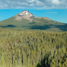
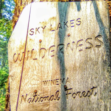
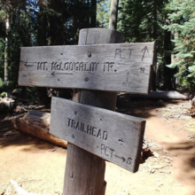
Mt. McLaughlin is the fourth highest stratovolcano in the Cascade Range in Oregon. Why not run around it? The trails and forest roads used on this route are in the beautiful Sky Lakes Wilderness in Southern Oregon. The Pacific Crest Trail runs on the east side of the mountain. Use the Twin Ponds #993 on the north side. Forest roads complete the west side to the Lake of the Woods Highway in the southern portion. Best to use the Fish Lake Trail #1013 and High Lakes Trail #6200 instead of the highway to safely connect to the PCT. There are plenty of lakes and creeks to do this route unsupported. Camping is available at the North Fork Campground, Doe Point, and Fish Lake Campground or stay at the Fish Lake Resort.
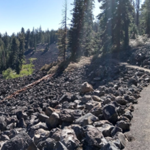
Besides the mountain, Old Growth forests, lava flows, and summer wildflowers offer plenty of scenery. Trails vary from dirt, lava, rocks, gravel, and soft pine needles.
Circumnavigation & Summit: 37 miles / 6800 feet of elevation gain. (car-to-car)


Comments
I’ll be attempting a supported FKT tomorrow at 8 am. It can be tracked at share.garmin.com/nwdirtchurners
I see this route's been getting some action lately and has a summit option now too. Super cool. Here's what this route's author had to say after attempting it on 9/20/2020 (copied from his Strava) "Sucks to DNF an FKT route that you made. It got really hot on the 10 mile asphalt climb and I got really dehydrated and started puking. I also got lost on the Twin Ponds Trail and had to bushwack for a couple miles. Basically, this route sucks. I never even saw the mountain on a clear day." This is why it's important to try out your routes before submitting them. I had a feeling this was the case when I first did this one. Oh well, it's here now. Good luck to those who come next and stay tuned for my own attempt at this loop again but with the summit this time...doh, never mind. It just snowed on the mountain!