Location
California,
US
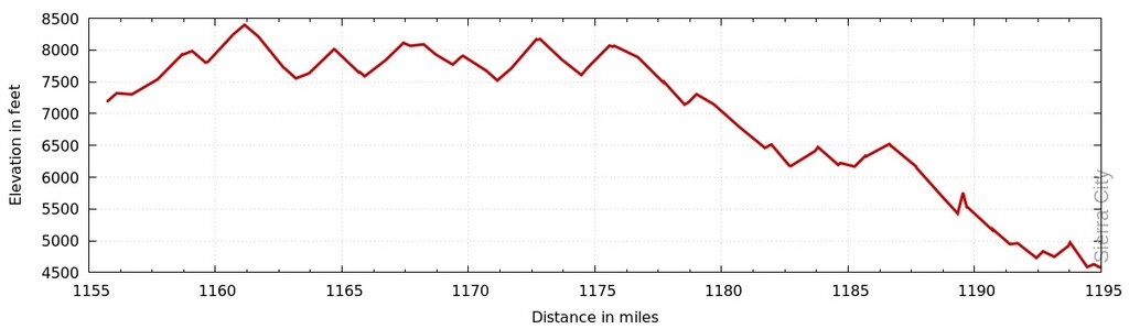
Distance
37.2 mi
Vertical Gain
5,111 m
Description
GPS Track
FKTs
Male
Female
| Jack Macy | 7h 26m 9s | ||||
| Christopher bord, Peter Brown | 9h 52m 53s | ||||
| Eric Kennedy | 11h 0m 5s |
| Holly Ryerson | 8h 1m 25s |
| Kate Lukacs | 8h 30m 0s |
Images