Route: South Yuba River National Recreation Trail (CA)

Submitted by benremitchell on Sun, 06/07/2020 - 06:16pm
Location
California, US
Distance
21 mi
Vertical Gain
3,000 ft
Description

Elevation Loss: 4,000 ft.  (East to West)

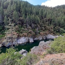
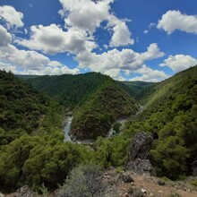
From east to west, the South Yuba Trail follows the South Fork of the Yuba River from the Poorman Creek parking lot just off of Relief Hill Road (just east of Washington, CA) to the Purden Crossing parking lot (outside of Nevada City, CA), totaling 21 miles. The first 15 miles are entirely on single-track and inaccessible by vehicle. The trail then coincides with North Bloomfield Road down to Edward's Crossing. After crossing the bridge the trail (single-track again) follows along the south side of the Yuba for about 5 miles before terminating at the parking lot just off of Purden Road.

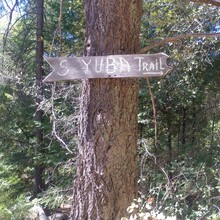
Note that shortly after the Round Mtn Tr junction (~mi 19.3) the trail splits. The lower route eventually widens into a fire road. The upper route stays single-track and is the true S Yuba Tr. In other words, stay left.

The terrain of the single-track is mostly soft dirt with scattered roots and rocks, though there are a few rocky, more technical sections.

Conditions: Attempting to even so much as hike this trail during the winter and spring months is HIGHLY inadvisable. The winter storms bring down an incredible amount of debris onto the trail, in particular on the upper (eastern) portion. Contacting Tahoe National Forest and BLM to find out if trail maintenance has been done is suggested. (It is typically done by late spring, but not always.) The western portion of the trail falls on South Yuba River State Park land and some private land. This portion is generally much better maintained as it gets much more foot traffic.

Resources:

https://www.nrtdatabase.org/trailDetail.php?recordID=2154#two

https://www.blm.gov/visit/south-yuba-river

https://www.alltrails.com/explore/map/south-yuba-trail--101

Route submitted by Ben Mitchell.

GPS Track
Images