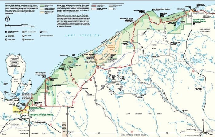
Location
Michigan,
US
Distance
41.8 mi
Vertical Gain
2,165 ft
Description
GPS Track
Pictured_Rocks.gpx437.04 KB
FKTs
Male
Mixed-gender team
Female
| Jason Schatz | 5h 56m 57s |
| Jake Hegge, Gretchen Metsa | 6h 45m 10s |
| Mia Rucoba | 6h 48m 14s | ||||
| Carrie Henderson | 7h 20m 16s | ||||
| Jamie Blumentritt | 7h 31m 46s | ||||
| Meagan Denman | 7h 48m 25s |
| Claire Luby | 7h 50m 4s |
Male
Female
| James Froehlich | 21h 30m 27s |
| Chantal Demers | 21h 51m 18s |
Images
This route on the old FKT site
Comments
I will be attempting the unsupported female FKT October 10, 2020. I will be tracked by my Garmin 735xt.
I just noticed that we both got FKTs on 10/10! (My name is also Carrie Henderson!) What a crazy coincidence. Congrats!!
Gretchen Metsa and I will be attempting the unsupported mixed-team FKT going east-west on 10/2/21.
I will be attempting the unsupported there and back FKT on 5/15/22. I will be tracked by my Garmin Instinct 2.
I've assembled a crew to try to improve on my previous Out-and-Back Pictured Rocks FKT. Shooting for 10/15/22. We will be running this time. Can't wait.
I will be attempting the unsupported out and back FKT on 5/16/23. Looking forward to it!
How'd it go James? Looking at maybe taking a swing at out n back self-supported this weekend.
Hello Stephen,
The run went great. The trail is in great shape through most sections however winter storms did a number on parts of it, especially around the mosquito beach area.
How did your run go?