Route: Bryce Canyon Traverse (UT)

Submitted by Anna Callaghan on Thu, 01/14/2021 - 11:00am
Location
Utah, US
Distance
30.5 mi
Vertical Gain
5,549 ft
Description

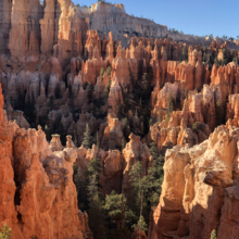
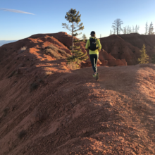
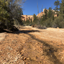
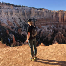
This is a pretty straightforward route that traverses a National Park (albeit a tiny one) and is a fun, very runnable 50k distance that has been done a number of times though doesn't seem to be popular. We didn't see a single person on the entirety of the Under the Rim Trail, which the park describes as unmaintained. There's certainly some blowdown in Agua Canyon (through an old burn) and a handful of washes to cross but they're easy to navigate. The run descends through into the canyon amidst red cliffs and hoodoos and then winds through forest (some dense and some open) before ascending onto red clay singletrack and finishing through the touristy hoodoo zones that are Bryce's main attraction. It saves the best views for last, but is an enjoyable run throughout. 

We ran a car shuttle, leaving one car at the finish, and started at Rainbow Point and finished at Fairyland Point, taking the Under the Rim Trail from Rainbow for the majority of the time (~21 miles). We then took the Peekaboo Loop Trail past Queens Garden and got onto the Rim Trail to Fairyland Point. 

*Not my documentation but this blog describes it well: http://ericjlee.com/Blogs/?p=1519

Craig Lloyd posted the same route except with the addition of the ~8 mile Riggs Loop on our old website:

"I recently ran what I have called the Bryce Canyon Link-Up. With a friend, we connected all three back country trails in Bryce Canyon and did them as a run.
We started at Rainbow Point and ran the Riggs Trail, then Under-the-Rim trail, and ended on the high side of the Fairytale Loop trail. I intended to do the lower, longer half, but my friend had a hurt knee and I was just anxious to get it over with.
I tried to do some research but couldn't find anyone else who has ever done this.

It turned out to be 37 miles.  One of the coolest runs I've ever done.

Trip report can be viewed at refusetoquit.blogspot.com/2010/06/bryce-canyon-link-up.html "

Craig ran this in 8h31m17s on 6/24/2010.  Jay Aldous repeated the same route in 7h40m on 10/25/2010.  Neither Craig nor Jay reported a time for the point-to-point section.

The Duathlon uses a bike to close the loop by riding the highway between the 2 trailheads.  This variation was submitted by Spencer McCullough: "I'd recommend leaving your bike at Fairyland Point if you're comfortable with that. This way you don't have to run the two miles to the visitor center. I refilled my water at the fountain at the visitor center before doing the rest of the ride back."

GPS Track

Comments

User Picture
Profile picture for user Dawson Oliver

I'm going for the unsupported male FKT tomorrow. 

User Picture
Profile picture for user calebolson

Going for it tomorrow with Jacob and Garrett

User Picture
Profile picture for user Lauren Head

Going for the women’s unsupported tomorrow! 

Hayden James and I are attempting this today ! 

User Picture
Profile picture for user marcy_beard

I'm considering doing the loop (run + bike).  I'd like to go north-to-south for the run and south-to-north for the bike (opposite direction of other FKT's).  If anyone sees an issue with this, please let me know.