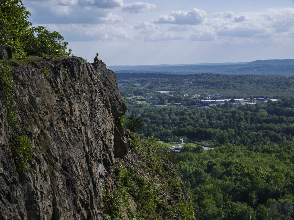
The northern terminus is just south of Mt. Monadnock at the NH/MA state border, and the southern terminus is at the Long Island Sound in Guilford, CT. It is just over 200 miles long, and it is one of the National Scenic Trails. It runs along rugged traprock ridges.
Lee-Stuart Evans ran the entire NET & described it briefly as follows:
The New England Trail is now 10 years old. It comprises 4 separate trails combined to traverse 225 miles from the New Hampshire/Massachussets border to Guilford in Connecticut on the coast in Long Island Sound. In essence the route takes in most of the Metacomet Range that runs down through the middle of Massachusetts and Connecticut.
The Massachusetts portion of the New England Trail is made up of most of the Metacomet-Monadnock Trail which is 114 miles long. The Metacomet Trail runs for 63 Miles through Connecticut before meeting up with the Mattabesset Trail which donates 33 miles to the ‘NET’. Finally the Menuckatuck Trail completes the last 16 miles to the coastline and the finish of the New England Trail at the coast in Long Island Sound. This gives a total NET traverse from New Hampshire to Long Island Sound of around 225 miles.
Art Byram described the route in a post announcing an attempt at the traverse of CT via the NET:
On June 10, 2017 at approximately 11 AM, Jordan Leigh and Art Byram (that’s me) and perhaps some others will meet at the Connecticut Massachusetts border in Rising Corner and follow the New England Trail (NET) South until we reach Long Island sound approximately 112 miles later by following the Metacomet Blue Blaze Trail then continuing on the Mattabesett trail until it joins with the Menunkatuck and follow this trail to its southern terminus at the Long Island Sound in Guilford Connecticut, thereby traversing the state of Connecticut from North to South along the beautifully rugged traprock ridges.
I estimate the mileage as follows: Metacomet trail 62.2 miles + Mattabesett (partial) 33.5 miles + Menunkatuck Trail 16.7 miles for a total of 112.4 miles. Here is a link to an interactive map: newenglandtrail.org/get-on-the-trail/map
The New England National Scenic Trail (NET) is a 215-mile hiking trail route that has been in existence for over half a century. The NET travels through 41 communities in Connecticut and Massachusetts, and is comprised primarily of the historic Mattabesett, Metacomet, and Monadnock (M-M-M) Trail systems and the newer Menunkatuck Trail.
We will be supported and joined at various times by friends and family, and are looking to have others join as they wish, whether for a few miles or for the whole traverse. To my knowledge, based upon last year’s FKT on the Metacomet, no one has recorded a time for this route, however if you have, or if you know someone who has, please let us know.
This route strings together some of the best trail running in Connecticut including Suffield Mountain, Peak Mountain, Hatchet Hill, Wilcox Park, Penwood State Park (Traprock 50k), Heublein Tower, MDC Reservoirs, Rattlesnake Mountain, Pinnacle Rock, Crescent Lake, Ragged Mountain, Castle Craig, Lamentation Mountain, Chauncey Peak, Mount Higby, Powder Ridge, Tri-Mountain State Park, Bluff Head (Bimblers Bluff 50k) , Cockaponset State Forest, East River Preserve, and the Guilford Point waterfront. These blue blaze trails are all maintained by Connecticut Forest and Parks Association. www.ctwoodlands.org/giving/make-one-time-donation
This is a beautiful route, that hopefully will catch on, and encourage others to take longer runs on this trail. What could be more beautiful than a journey in the woods? Please let me know if you are interested in joining for some or all of this run, otherwise I will post an update after we are finished.
Comments
Having this trail in my backyard I’ve always wondered if anyone has set an FKT. This is awesome to see. I was wondering how is the river crossing handled?
Question, the New England Trail (NET) appears to have added what essentially appears to be an out and back section on the Mattabesett Trail consisting of CT NET Sec 1 - 4 and a partial split of the Menunkatuck Trail CT NET Sec 8? What are the feeling for inclusion of this in the FKT of the NET or would this be considered a side trail? Lee-Stuart Evens FKT does not include this section. Thoughts?
The Middletown Spur section of the NET is a great trail, but should not be included in the standard route, as it is superfluous and detracts from the overall elegance of the primary route. The trail seeks to connect mountains with the Long Island Sound; taking a side trip to the river makes no sense in my opinion. The 60 mile Mattabesset Trail is a worthy, logical route in its own right.
The CT NET Section 8 map incorrectly labels sections of the Mattabesset as the Menunkatuck. Essentially the Menuncatuck travels South at the junction, and the Mattabesset continues from Middletown through Bluff Head to its terminus at RT 15.
My husband, Scott Livingston and I are giving the full NET a try plus the M and M Trail section from the NH/MA because.....why the hell not? We are starting tomorrow, 6/17/2020 on top of Mt Monadnock. We stashed a cache in 2 spots and a kayak to cross the CT River. We will be self-supported. We’ll let you know how it goes!
Earlier this week, Debbie and I completed our NET Adventure. You can see the full report here. Instead of starting at the NH/MA border, we started at the summit of Monadnock. We felt it was appropriate too begin at the summit. The 18 or so (more like 22) miles of the NH Metacomet-Monadnock Trail is not official part of the New England National Scenic Trail, but it makes logical sense that it would be.
Our official Self-Supported FKT's (so far) no cover the NET Full Trail (MA & CT), and also Connecticut Only and Massachusetts Only. We have to figure out how the route from Monadnock factors in and are unclear if we will push to add this variation. There is some confusion (for us) as there is a separate FKT Route for the Metacomet-Monadnock Trail that includes the NH and MA sections. It stops at the MA/CT border. The NET is supposed to mirror the M-M Trail in MA, but it may be that there are a few deviations. We plan to compare notes (and GPS tracks) with fellow NET End-to-Ender Lee-Stuart Evans.
Our report covers it all, but in summary, this is an amazing trail and we had an amazing journey covering 242+ miles (including our Connecticut River paddling adventure) in 5d, 11h, 46m.
We got great support from many in our our preparation and are happy to share what we know with aspiring E2E'ers.
Tomorrow I will be attempting the first known unsupported time on the NET. I'm starting from the NH/MA border in the am and heading south to the Long Island Sound. TTYL!
Pushing the start back a day. Beginning early Saturday morning
On April 19th, i will set out to attempt the MA section of the New England Trail, unsupported. i will start at the north end and travel south. Can anyone please tell me how many miles the MA section adds up to? I cannot find the data anywhere, and dont know what program to open a gpx file with.
April 19th 2022.
hey good luck on the run! a few notes:
- i highly recommend you get a GPX reader (both for planning and for the run). the NET can be hard to follow in spots, even if you have done all the sections prior.
- the NET in MA has a couple "road walk" detours - those add mileage, but for an unsupported runner at this time of year i don't think you have another option. water will be cold and it's not a pleasant swim even in the summer.
- i have the total mileage (including those road walks) around 110-115 miles
I will be starting a supported FKT attempt of the New England Trail tomorrow morning (6/18/22) around 5am. I am starting at the NH/MA border and will be walking the Connecticut River detour through Northampton. I will be crewed by my dad and mom and paced for a section by my cousin Joey!
-Brooke
Hi! I will be starting an unsupported northbound hike the morning of September 7, 2023.
I’ll be beginning at the southern terminus and taking the Connecticut River detour as per the recommendation of the New England Trail Association. I will be ending my hike at the MA/NH border.
-Timothy
Marc Kelly and I (Tyler Tulloch) will be starting our supported attempted of the full NET at 11am today (5/29). Live tracking: https://share.garmin.com/Y7AOS
I am going to be going for the Unsupported FKT going NOBO starting June 16. Will be tracking via strava https://www.strava.com/athletes/74681644 and on Instagram @chickenfat_mas_miles
Hope I don't die.
Update, flaked out on day 3 at the end because I was too far behind from oversleeping.
originally was going to use my inflatable pad and swim across the river, but woke up late on day 3 and didn’t feel comfortable crossing the river in darkness.
if your pack is small and you have a wide xlite plus a pillow as an emergency drowning backup (or 9oz life jacket) I think it’s a solid plan if a good swimmer.
I figure it should count since there is “no trail” and you’re trying to get from A to B as fast as possible under your own power while carrying everything you use.
good luck to the next one and man is that a hard trail
This week I will be attempting to establish a new overall FKT on the New England Trail. I will start my journey at the MA/NH border early Thursday morning (11/14) and, if all goes to plan, will finish at the Long Island Sound Saturday evening (11/16). This run will be a self-supported effort.
The past couple of weeks, the NET (CT-Section 13) was closed going over Lamentation Mountain between the Berlin Turnpike and Giuffrida Park due to the Hawthorne Fire. I was told this area was opening back up, so hopefully I won't find any closure signs when I arrive. There isn't an official reroute for this section, so if I find the trail closed, then I will take Atkins St down to Country Club Rd until I arrive at the southern entrance to Giuffrida Park where it is open again. This will replace about 4 miles of trail with about 5 miles of road.
Everything is set in place and I'm feeling quite nervous and excited to get going!
Live tracking at https://share.garmin.com/Weston13
How do we feel about swimming the CT river instead of adding the 11-mile road walk for unsupported people?
I have since done a little more digging on this and also believe that the swim is not a good idea
Doesn't feel like a swimmable section. I opted for a SUP after reading the Livingston's adventure. (Kayaks). Still human powered without the danger.
Be wary of the Westfield River too. Sometimes crossable, many times definitely NOT
I am starting at the northern terminus tomorrow (8/15/2025) for an unsupported thru hike. If Friday, Saturday, and Sunday go well I will be calling out of work monday and attempting to finish the trail within 104 hours.
I, Reed Allen, am starting a self-supported Sobo attempt of the New England Trail. I plan to begin around 1230AM September 27th. I plan to road walk around the CT river crossing and walk through the Westfield River. I have a couple of water caches with some food stored. I hope to complete this task by October 1st at 8am
My name is Max Miranda and I’m going for an unsupported New England Trail FKT starting ~8:30 am on 4/17/26. I’ll be heading Northbound, hiking around the CT River via Northampton. I’m also targeting the self-supported and supported/overall time.
https://live.garmin.com/longtrailwalker
My name is Livvy Weld and I am going for an overall record of the NET but in an unsupported fashion. I will go SOBO starting Wednesday 5/20/26 around 5am and hopefully finishing on Saturday evening 5/23/26. I plan to do the road walks around the CT river and the Westfield river. Woohoo!