Location
Nevada,
US
Distance
7.4 mi
Vertical Gain
2,800 ft
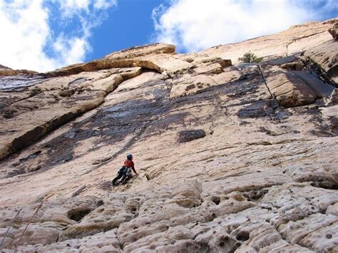
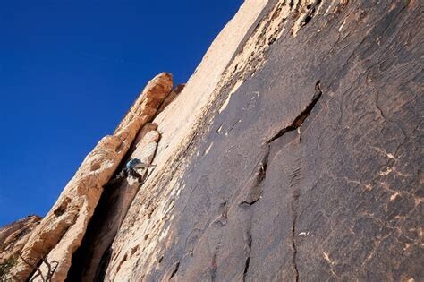
Description
GPS Track
FKTs
Male
Female
| Travis Soares | 1h 32m 54s | ||||
| Raymond Fong | 1h 45m 5s | ||||
| Jason Hardrath | 1h 51m 20s | ||||
| Christopher C Gorney | 2h 38m 56s | ||||
| Jason Hardrath | 3h 19m 2s | ||||
| Christopher C Gorney | 6h 7m 26s |
| Isabel Reback | 3h 27m 49s | ||||
| Ashly Winchester | 4h 56m 40s |
Male
| Travis Soares | 2h 23m 5s |
Images
Comments
Here is some fun, palm-sweat-inducing, storytelling of when I "hard scrambled" up Solar Slab (via Solar Slab Gully) to get the FKT on this mountain, but ended up on one of the harder-than-5.6 variations due to needing to bypass a nervous, beginner trad-climbing team...
again, trigger warning, it is a sweaty-palm inducing story of being 1500’ above ground, without a rope...
https://youtu.be/K_RrVyCygP8?t=2097
(run time: 9 min, 34:57- 43:53)
As I say in the video, this FKT is intentionally left open to taking "Any Route", such as Chris Gorney's amazing effort on "Rainbow Direct" that got him the FKT, because I knew my vendetta with Solar Slab was a personal one.
Hope you enjoy!
with stoke,
Jason Hardrath
Should we get another tab for Solar Slab here? In my opinion its a classic enough climb to earn its own route tab yeah? Just a suggestion!
Travis,
IMO, I think that would be reasonable, I agree SS is a five star, mega-classic rock line in the conservation area. My 2020 effort to the summit followed Solar Slab up past its final anchors to the summit.
Are you proposing a car-to-car just to the top anchors and back down? or one like mine that continues on to the summit and back down?
I personally like the aesthetics and flow of how you did it Jason to the summit of Rainbow. So I'm in favor of car to car and tag the summit.
Jason, I'm very curious what your path after the anchors of Solar slab was like, much in the way of 5th class to the true summit?
ashchetum - reach out to to Travis Soares and I on socials to chat more we both soloed the section above - I'd say it went about 5.7 for some moves.
That helps a lot, I'm not interested in soloing it, but I am really interested in topping out rainbow mountain via solar slab on ropes and I was curious how much more real climbing there would be and how protectable it may be.