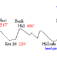
The Blue Hills Skyline Trail is located in the Blue Hills Reservation, in Milton, MA, just minutes from downtown Boston. The Reservation covers 7,000 acres of rugged, forested landscape. There are an amazing 125 miles of trails in the Reservation. A 2-page brochure with trail map is here. The classic trail in the park is the 9-mile, blue blazed Skyline Trail. The trail has a total of roughly 2500 vertical feet of altitude gain. Some other hikes and information are located on this site.
On September 27, 2009, Ben Nephew ran the Skyline out & back in 2h45m3s. He started at the Shea Rink and ran from east to west. In the western section, Nephew chose to go out on the Skyline South and return on the Skyline North. "My turn around spot was the random guard rail in the trees where the trail seems to stop, both on the map, and in reality," he said. He reached the turn around at 1h17m30s.
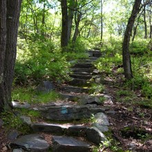
You might think that anything a few miles from downtown Boston can’t be too difficult, but the Skyline has surprised many runners. I have a hard time saying this, but this run was the most technically challenging run I’ve ever done. It is amazing how much climbing they fit into a nine mile trail in this part of the state that is so very flat. There are 6-7 stone staircases in both directions, and the footing is straight out treacherous over about 16 of the 18 miles. The feeling of crunching a foot between two rocks is all too common on the Skyline Trail, and there are few good places to fall. You will usually end up in a pile of very sharp rocks. It didn’t help that it rained all day, but that probably kept me from trying to run too fast on the descents. -- Ben Nephew
Nephew has since lowered his own out & back FKT several times.
Important Note: For a single traverse you must go one direction on the Skyline North trail and the Skyline South in the opposite direction. For a double traverse you must take each the Skyline North and Skyline South in both directions. (Regional Editor, 4/6/21)


Comments
I like running on this trail, but I'm nowhere near the FKT.
FWIW On the women's side of things, there appear to be at least two Strava reports of comparable or faster times by folks covering the whole trail (instead of turning around at Great Blue Hill). https://www.strava.com/segments/11793409